Tuesday 21 September 2021

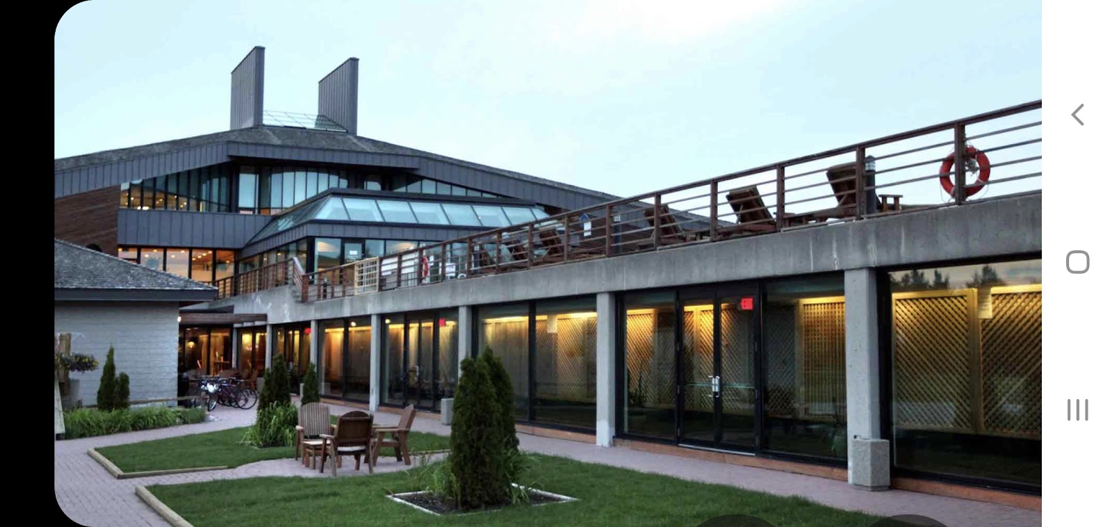
King City- Kingsbridge Centre


Built in 1989

by Murray Koffler – founder of the Shopper’s Drug Mart and co-founder of The Four Seasons Hotels – as Canada’s first world class spa facility.

In 1992 CIBC, under the leadership of Chairman Al Flood, converted the property into a private state-of-the-art training facility for their leaders.

Purchased in 2001 by John Abele – The Kingbridge Centre was founded in 2001 by John Abele, cofounder of Boston Scientific and a global leader in the field of less invasive medicine. The Kingbridge vision was inspired by Mr. Abele’s passion for technological inventions, concepts and ideas made to benefit communities and society as a whole. His involvement in these areas influenced him to envision a living learning place that supports innovation where groups of people could come together to collaboratively solve problems. In January 2021, Mr. Abele made the decision to retire, entrusting the ownership of the Kingbridge Centre to the Pathak Family Trust and its affiliated entity Ekagrata Inc.

Purchased in January 2021 by the Pathak Family Trust and its affiliated entity Ekagrate Inc – The Kingbridge Centre will continue to deliver world-class residential convening, leadership development, corporate training, conferencing and retreat services while being committed to engaging with local community. The Pathak Family Trust is committed to upholding the standard of innovation, discovery, and excellence long represented by the Kingbridge Centre, and to continue the strong partnerships with local community, government and academia. Kingbridge’s new Chairman, Prashant Pathak, has been involved in Mr. Abele’s vision and mission alongside the Kingbridge team for over 15 years and is excited to carry on the legacy of collective learning, problem solving, leadership development and innovation. Mr. Abele will continue to advise Mr. Pathak and the rest of the Kingbridge team as Chairman Emeritus.

Mr. Pathak has begun to expand The Kingbridge vision by engaging with key stakeholder partners to harness the infrastructure of the Kingbridge Centre to drive economic prosperity by accelerating groundbreaking innovations that drive community transformation, and scale up environmental initiatives which make a positive impact in the world. Food, Agriculture, Energy, Water are four of the key focus areas of the Kingbridge Centre aligned with economic priorities of King Township and York Region. Programming will be developed and offered to support these objectives, help foster leaders and convene people who are interested to explore new ideas and collaboratively solve problems from a higher level of thinking, creativity, skills and shared purpose.

Due to COVID-19, from May 2020 The Kingbridge Centre has been serving as a Temporary Transitional Shelter for York Residents in need, through a partnership with The Regional Municipality of York and Salvation Army. This partnership is due to continue until June 2021. Looking beyond the current situation with the COVID-19 pandemic, the Kingbridge Centre team is looking forward to being a partner in supporting economic recovery efforts, and growing innovative businesses. Mr. Pathak’s extensive global network, experience with risk capital investing and building businesses will support those efforts. Plans will be announced later this spring.

Thursday 4 March 2021

The Black Eagle Palace Oradea Romania

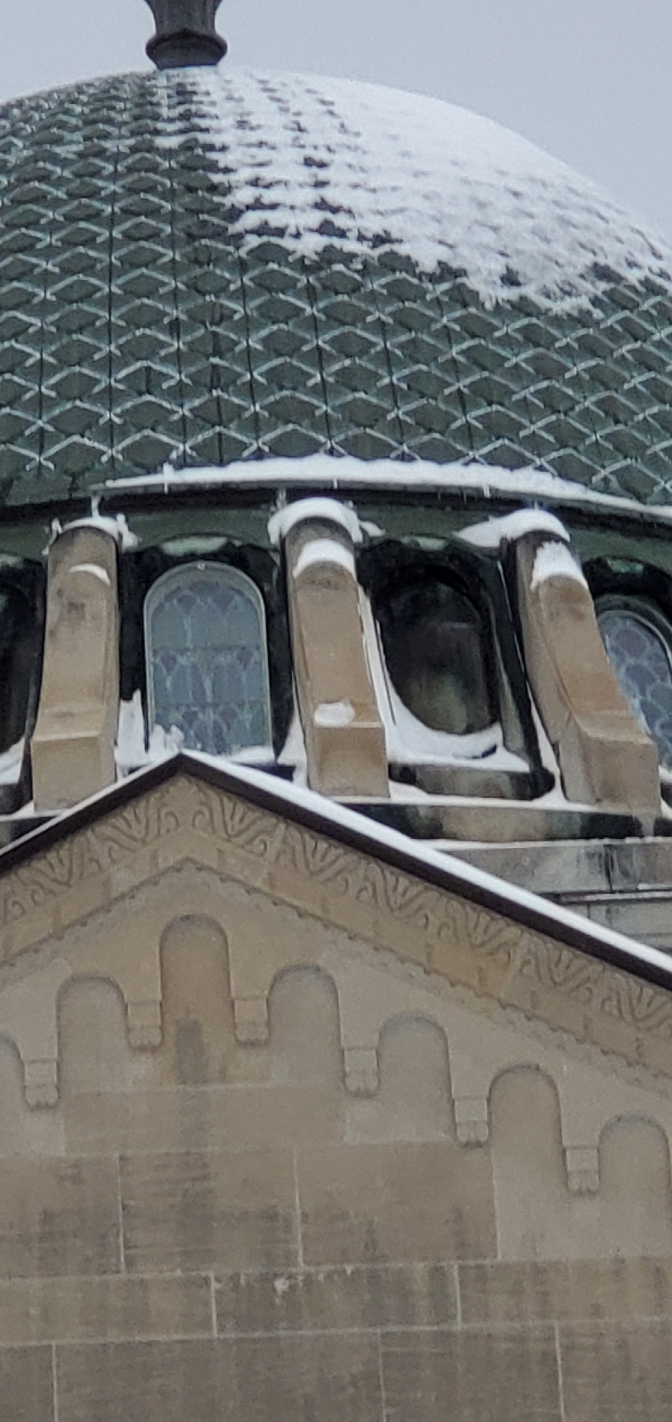
The Black Eagle Palace is the most spectacular secession style architectural achievement in Oradea, Romania.
The story of the Black Eagle Palace is linked to the new urban development vision of the city, given the reorganization of the Small Square (St. Ladislau Square), today Union Square. In 1714, on the site of the building located at the intersection of Independence street (strada Independenței) with the Square, there was a one-storey venue, called the Eagle Inn or the Town’s Beer House.

The old inn hosted most of the city’s major public events: balls, meetings, theatre shows or political events. Until 1761 it was only a small building with three rooms that accommodated the town hall. Then, in 1807 it was rebuilt, extended and it was added another floor, and after a second modification, in 1835, it became an important hotel in the city.

Sunday 27 December 2020

Thomas Foster Memorial Uxbridge Ontario Canada


Thomas Foster was

born near Toronto, and raised in Scott Township north of Uxbridge where his father ran the Leaskdale Hotel. He became a butcher in Cabbagetown in Toronto, was elected M.P., and served as mayor of Toronto from 1925 to 1927. He also made a large fortune from real estate.

The Thomas Foster Memorial

[Photo]

Foster visited India in his late seventies. After seeing the famous Taj Mahal, Foster was inspired to build a memorial in his boyhood community, with a Christian adaptation. The Memorial was erected in 1935-36, and cost $250,000. It contains three crypts for Mr. Foster, his wife and daughter.

J.H. Craig, (1889 - 1954), was the principal architect of the temple. Together with artchitect H.H. Madill (1889 - 1988), they worked on an entirely new and original design based on Byzantine architecture.

An Unusual Contest

Thomas Foster held a contest to find the lady who could have the most children in 10 years.

[Photo]

An Unusual Will

to feed Toronto birds in winter.Included in Thomas Foster's will were funds:

for needy newsboys in Toronto.

to plant trees on roads leading into Toronto.

to apprehend poachers around Toronto.

for an annual inner-city school picnic.

for cancer research.

for the Leaskdale Sunday School.

to maintain the Memorial.

Thomas Foster (July 24, 1852 – December 10, 1945) was the Mayor of TorontoOntario, Canada from 1925 to 1927.

UXBRIDGE -- Just a few kilometres north of Uxbridge on Durham Road 1 sits the Thomas Foster Memorial

A picturesque structure, located on a hill on the east side of the road, the building was constructed by Thomas Foster in 1935-36 and contains crypts for Mr. Foster, a former mayor of Toronto, his wife Elizabeth McCauley and young daughter Ruby, who died at the age of 10.

 -

Not one piece of wood was used in the construction of the building, which features an octagon-shaped base which the building sits on, a stunning copper roof, carved stone and hand-painted eye-catching windows. The floors feature rich-coloured terrazzo and marble mosaics in symbolic designs.

Upon entrance, patrons cross the ‘River of Death’, in which floats water lilies and lily pads.

The list of other visually pleasing features of the property, which is designated under the Ontario Heritage Act, is simply too long to list.

It is certainly a place, though, where first impressions make an impact.

Count Corey Keeble among those who’ve experienced that. In the fall of 2013, Mr. Keeble was the Royal Ontario Museum’s curator and he visited the Foster for the first time. 

Some or all of the facility has been used countless times to film television shows and movies. Most recently, the popular CBC’s show Murdoch Mysteries took over the Foster for a season eight episode titled: Murdoch and the Temple of Death. The episode aired in January of 2015.

Others have written books to raise awareness about the Foster. In 2014, local author Conrad Boyce wrote ‘Jewel on the Hill: the story of Ontario’s Thomas Foster Memorial.’

“The diamond of Durham it was dubbed and it is definitely the diamond of Durham and beyond. It’s one of a kind,” says longtime Foster supporter and member of the Friends of the Foster committee, Bev Northeast.

The Foster Memorial is open to the public on the first and third Sunday of the month from June to September and is the site of a weekly concert series, Fridays at the Foster, starting in May each year.

Thomas Foster 

BornJuly 24, 1852
York TownshipCanada West
DiedDecember 10, 1945 (aged 93)
NationalityCanadian
OccupationButcher, Meat Cutter
40th Mayor of Toronto
In office
1925–1927
Preceded byWilliam W. Hiltz
Succeeded bySamuel McBride


Early lifeEdit

The son of John T. Foster and Frances Nicholson, Thomas Foster was born July 24, 1852, in Lambton Mills, Ontario. His family soon moved to Leaskdale, Ontario after his mother's death.

He started his working life as a butcher's boy in Toronto, until he saved enough money to purchase his own butcher shop for $50. The earnings from that business allowed him to purchase property which became the source of his eventual wealth.

Political career

He was first elected as an alderman for St. David Ward in 1891, then reelected in 1892 and 1894. In 1895 he lost the election, and did not return to council until 1900 as an alderman for Ward 2, a position which he held until 1909. He was elected to the Toronto Board of Control in 1910; however, he lost the 1911 election. In 1912 he was again elected Controller and kept his seat until 1917.

Foster served as a Member of House of Commons of Canada from 1917 to 1921. He was elected as a Union Government candidate in the 1917 federal election for East York. He lost in his party's nomination so he ran as an independent in Toronto East in the 1921 election but failed to keep his seat.

Foster returned to City Council for the next three years, then was elected as mayor in 1925. He was a great supporter of Hydro expenditures and loved flowers. As an alderman he fought for the rebuilding of the pavilion at Allan Gardens after it had been destroyed by fire. In his 25 years of civic service he earned the informal title of "Honest Tom". As mayor of Toronto he was reported to have saved the city two million dollars by rigid economics.

Foster was known to collect the rents on his properties in person, even when he was mayor. If a tenant complained about a problem, or wanted a bit of work done, Foster would go out to his car, get his tools and fix the issue on the spot.[1] His penny pinching eventually led to his defeat due to his refusal to raise police salaries.[1]

Later years and legacy

He was a great traveler and on one of his trips he was inspired by the Taj Mahal. In 1935 and 1936 he had a memorial temple constructed on a hill between Leaskdale and Uxbridge, Ontario, for his family at a cost of $200,000. The temple was designed by Foster with architects H.H. Madill and James H. Craig[2] and inspired by Mughal architecture and Byzantine architecture.

He died at the age of 93 and is buried in the massive mausoleum on a hill north of town on Durham Regional Road 1 which includes the remains of Foster, his wife and daughter. Foster left $80,000 in funds to maintain the property in perpetuity but the trustees spent the principal and the funds had dried up by the 1990s, leaving the Town of Uxbridge to take over responsibility for the monument. In 2013, it was estimated that $1 million was needed to repair and restore the building, a controversial task given that the entire budget for the municipality was only $14 million.

Among other things, Foster left $500,000 for cancer research, $100,000 for an annual picnic to be held at Exhibition Park for school children, and funds to feed wild birds in Toronto. Inspired by the Great Stork Derby, Mayor Foster also sponsored a contest to reward mothers for their skills at procreation. The prizes were $1,250 for first, $800 for second, and $450 for third. Four ten-years periods began and ended on his death date, and ran from 1945–55, 1948–58, 1951–61, and 1954-64.[3]

A bronze portrait medallion of Thomas Foster by Christian Corbet was publicly unveiled in 2009 and is permanently housed in the memorial.[citation needed]

He was also a member of the Orange Order in Canada.

Electoral record

Municipal

Federal

1917 Canadian federal election: York East
PartyCandidateVotes
Government (Unionist)Thomas Foster9,736
LiberalRoss Collier Cockburn5,758
LabourJames Hamilton Ballantyne3,338
1921 Canadian federal election: Toronto East
PartyCandidateVotes
ConservativeEdmond Baird Ryckman5,392
ProgressiveWalter Leigh Rayfield3,984
IndependentThomas Foster3,680
LabourJohn William Bruce1,822
LiberalElizabeth Bethune Kiely52


Thursday 11 June 2020

Seneca Village a Story of Removing Balck People from the Land to Build a Park- Central Park of Manhatan

An important part of New York City’s African-American heritage lies hidden in Central Park’s murky pre-history. Although it’s difficult to imagine a time when the 843 acres between 59th and 110th was not beautiful parkland, Central Park was once private property, occupied by a variety of businesses and residences, including an African-American neighborhood called Seneca Village. Located between 82nd and 89th Streets and Seventh and Eighth Avenues, Seneca Village was New York City’s first prominent African-American community, and its destruction displaced over 250 land-owning African Americans. Seneca Village was never re-established in another location, and its demolition is considered one of the great casualties of Central Park’s creation. 

Seneca Village was a 19th-century settlement of mostly African American landowners in the borough of Manhattan in New York City, within present-day Central Park. The settlement was located on about 5 acres (2.0 ha) near the Upper West Side neighborhood, approximately bounded by 82nd and 89th Streets and Seventh and Eighth Avenues, had they been constructed. 

Seneca Village was founded in 1825 by free blacks, the first such community in the city. At its peak, the community had 264 residents, three churches, a school, and two cemeteries. The settlement was later inhabited by several other minorities, including Irish and German immigrants. Seneca Village existed until 1857, when, through eminent domain, the villagers and other settlers in the area were ordered to leave and their houses were torn down for the construction of Central Park. The entirety of the village was dispersed except for one congregation that relocated.
Several vestiges of Seneca Village's existence have been found over the years, including two graves and a burial plot. The settlement was largely forgotten until the publication of Roy Rosenzweig and Elizabeth Blackmar's book The Park and the People: A History of Central Park in 1992. The Seneca Village Project was formed in 1998 to raise awareness of the village, and several archeological digs have been conducted. In 2001, a historical plaque was unveiled, commemorating the site where Seneca Village once stood. 


Map showing the former location of Seneca Village (Egbert Viele, ca. 1857)

Development

The land was originally purchased by a white farmer named John Whitehead in 1824. One year later, Whitehead began selling off smaller lots from his property. At the time, the area was far from the core of New York City, which was centered south of 23rd Street in what is now Lower Manhattan. On September 27, 1825, a young African American man named Andrew Williams purchased three lots from the Whiteheads for $125. On the same day, African Methodist Episcopal Zion Church (AME Zion Church) trustee Epiphany Davis bought twelve lots for $578. The AME Zion Church bought six additional lots the same week, and by 1832, at least 24 lots had been sold to African Americans. Additional nearby development was centered around "York Hill", a plot bounded by where Sixth and Seventh Avenues would have been built, between 79th and 86th Streets. York Hill was mostly owned by the city, but 5 acres (2.0 ha) were purchased by William Matthews, a young African American, in the late 1830s. Matthews's African Union Church also bought land in Seneca Village around that time.
More African Americans began moving to Seneca Village after slavery in New York state was outlawed in 1827. In the 1830s, people from York Hill were forced to move so that a basin for the Croton Distributing Reservoir could be built, so many of York Hill's residents migrated to Seneca Village. Later, during the potato famine in Ireland, many Irish immigrants came to live in Seneca Village, swelling the village's population by 30 percent during this time. Both African Americans and Irish immigrants were marginalized and faced discrimination throughout the city. Despite their social and racial conflicts elsewhere, the African Americans and Irish in Seneca Village managed to live in close proximity. By 1855, one-third of the village's population was Irish. George Washington Plunkitt, who later became a Tammany Hall politician, was born in 1842 to two of the first Irish settlers in the village, Pat and Sara Plunkitt. Richard Croker, who later became the leader of Tammany, was born in Ireland, but he came with his family to Seneca Village in 1846, and lived there until his father got a job that enabled them to move.
 
The one-story frame-and-board houses in Seneca Village were referred to as "shanties", which reflected their roughshod outward appearance, though some of the houses resembled log cabins. While the houses were not professionally constructed, their interiors were an improvement on the cramped tenements of Lower Manhattan. Land ownership among black residents was much higher than that in the city as a whole: more than half of blacks owned property in 1850, five times as much as the property ownership rate of all New York City residents. One-fifth of Seneca Village's inhabitants owned their residences. Many of Seneca Village's black residents were landowners and relatively economically secure compared to their downtown counterparts. At least one property owner, the Lyons family, lived in Lower Manhattan but owned property in Seneca Village.
 
Nevertheless, many of the residents were still poor, since they worked in service industries such as construction, day labor, or food service, and only three residents (two grocers and an innkeeper) could be considered middle-class. Many black women worked as domestic servants. Many residents "squatted", boarding in homes they did not own, demonstrating that there was significant class stratification even with Seneca Village's high land ownership rate.
The residents relied on the abundant natural resources nearby, such as fish from the nearby East River and Hudson River, and the firewood from nearby forests. Some residents also had gardens and barns, and fed their livestock scraps of garbage. Two bone disposal plants were located nearby, at 66th and 75th Streets.

Inhabitants

In 1855, a New York state census found that Seneca Village had 264 residents. On average, the residents had lived there for 22 years. Three-quarters of the 264 residents recorded in 1855 had lived in Seneca Village since 1840 or before, and nearly all had lived there since 1850. At this time in New York City's history, most of the city's population lived below 14th Street; the region above 59th Street was only sporadically developed and was semi-rural or rural in character.
 
After slavery in New York was outlawed, African American men in the state could vote as long as they had $250 worth of property and had lived in the state for at least three years. 

Of the 13,000 black New Yorkers, 91 were qualified to vote, and of the voting-eligible black population, 10 lived in Seneca Village. The purchase of land by blacks had a significant effect on their political engagement. Blacks in Seneca Village were extremely politically engaged in proportion to the rest of New York.

Community institutions

The economic and cultural stability of Seneca Village enabled the growth of several community institutions. The village had three churches, two schools, and two cemeteries by 1855, two-thirds of the inhabitants (180 of 264 total) were regular churchgoers. Two of the churches, First African Methodist Episcopal Zion Church of Yorkville and African Union Church, were all-black churches, while All Angels' Church was racially mixed
The AME Zion Church, a denomination officially established in lower Manhattan in 1821, owned property for burials in Seneca Village beginning in 1827. In 1853, the Church established a congregation and built a church building in Seneca Village. 

According to the New York Post, the cornerstone included a capsule with "a Bible, a hymn book, the church's rules, a letter with the names of its five trustees and copies of the newspapers, The Tribune and The Sun". The church building was destroyed as part of the razing of Seneca Village.
 
The African Union Church purchased lots in Seneca Village in 1837, about 100 feet (30 m) from AME Zion Church. It had 50 congregants. The church building contained one of the city's few black schools at the time, Colored School 3, founded in the mid-1840s.One of the teachers in the school was 17-year-old Catherine Thompson.
 
All Angels' Church was founded in 1846 as an affiliate of St. Michael's Episcopal Church, the main campus of which was located at Amsterdam Avenue and 99th Street.

 All Angels' was intended to be a mission to the residents of Seneca Village and nearby areas. At first, the church was hosted in a white policeman's home, but a wooden church at 84th Street was built in 1849. The congregation was racially diverse, with black parishioners from Seneca Village and Irish and German parishioners from other nearby areas. It had only 30 parishioners from Seneca Village. When the community was razed, the church relocated a few blocks west and was officially incorporated at the corner of 81st Street and West End Avenue.


Planning of Central Park

By the 1840s, members of the city's elite were publicly calling for the construction of a new large park in Manhattan. Two of the primary proponents were William Cullen Bryant, the editor of the New York Evening Post, and Andrew Jackson Downing, one of the first American landscape designers. The Special Committee on Parks was formed to survey possible sites for the proposed large park. One of the first sites considered was Jones's Wood, a 160-acre (65 ha) tract of land between 66th and 75th Streets on the Upper East Side. The area was occupied by multiple wealthy families who objected to the taking of their land, particularly the Jones and Schermerhorn families. Downing stated that he would prefer a park of at least 500 acres (200 ha) at any location from 39th Street to the Harlem River. Following the passage of an 1851 bill to acquire Jones's Wood, the Schermerhorns and Joneses successfully obtained an injunction to block the acquisition, and the transaction was invalidated as unconstitutional.
 
The second site proposed for a large public park was a 750-acre (300 ha) area labeled "Central Park", bounded by 59th and 106th Streets between Fifth and Eighth Avenues.The Central Park plan gradually gained support from a variety of groups. After a second bill to acquire Jones's Wood was nullified, the New York State Legislature passed the Central Park Act in July 1853; the act authorized a board of five commissioners to start purchasing land for a park, and it created a Central Park Fund to raise money.
In the years prior to the acquisition of Central Park, the Seneca Village community was referred to in pejorative terms, including racial slurs. Park advocates and the media began to describe Seneca Village and other communities in this area as "shantytowns" and the residents there as "squatters" and "vagabonds and scoundrels"; the Irish and black residents were often described as "wretched" and "debased". The residents of Seneca Village were also accused of stealing food and operating illegal bars. 

The village's detractors included Egbert Ludovicus Viele, the park's first engineer, who wrote a report about the "refuge of five thousand squatters" living on the future site of Central Park, criticizing the residents as people with "very little knowledge of the English language, and with very little respect for the law".  While a minority of Seneca Village's residents were landowners, most residents had formal or informal agreements with landlords; only a few residents were squatters with no permission from any landlord.

Razing

In 1853, the Central Park commissioners started conducting property assessments on more than 34,000 lots in and near Central Park. The Central Park commissioners had completed their assessments by July 1855, and the New York State Supreme Court confirmed this work the following February. As part of the tax assessment, residents were offered an average of $700 for their property.

The minority of Seneca Village residents who owned land were well compensated. For instance, Andrew Williams was paid $2,335 for his house and three lots, and even though he had originally asked for $3,500, the final compensation still represented a significant increase over the $125 that he had paid for the property in 1825.
 
Clearing occurred as soon as the Central Park commission's report was released in October 1855. The city began enforcing little-known regulations and forcing Seneca Village residents to pay rent. Members of the community fought to retain their land. 

For two years, residents protested and filed lawsuits to halt the sale of their land. However, in mid-1856, Mayor Fernando Wood prevailed, and residents of Seneca Village were given final notices. 

In 1857, the city government acquired all private property within Seneca Village through eminent domain, and on October 1, city officials in New York reported that the last holdouts living on land that was to become Central Park had been removed.

A newspaper account at the time suggested that Seneca Village would "not be forgotten ... [as] many a brilliant and stirring fight was had during the campaign. But the supremacy of the law was upheld by the policeman's bludgeons."
 
All of the inhabitants of the village were evicted by 1857, and all of the properties within Central Park were razed. The only institution from Seneca Village to survive was All Angels' Church, which relocated a couple of blocks away, albeit with an entirely new congregation. There are few records of where residents went after their eviction, as the community was entirely destroyed.

An Australian newspaper in 1920 had described "a famous old woman [...] still living at 90 years of age" in Hawaii, who was said to have been born in Seneca Village. By 1997, The New York Times reported that no one had been identified as a descendant of a Seneca Village resident.
 
Elsewhere in Central Park, the impact of eviction was less intense. Some residents, such as foundry owner Edward Snowden, simply relocated elsewhere. Squatters and hog farmers were the most affected by Central Park's construction, as they were never compensated for their evictions.
 
Some traces of Seneca Village persisted in later years. As workers were uprooting trees at the corner of 85th Street and Central Park West in 1871, they came upon two coffins, both containing black people from Seneca Village. A half-century later, a gardener named Gilhooley inadvertently found a graveyard from Seneca Village while turning soil at the same site. The site was named "Gilhooley's Burial Plot" in honor of his discovery.

Rediscovery

The settlement was largely forgotten for more than a century after its demolition. Public interest in Seneca Village was invigorated after the publication of Roy Rosenzweig and Elizabeth Blackmar's 1992 book The Park and the People: A History of Central Park, which described the community extensively. 
 https://www.nycgovparks.org/news/daily-plant?id=18599

Monday 1 June 2020

Old Buildings Aurora Ontario Canada


The community was first known as Machell's Corners and had only 100 residents in 1851. The population of Aurora in 1863 was 700, and by 1869 it had grown to 1200. The settlement was incorporated as a village in 1863 with Charles Doan as the first reeve.

Aurora (2016 population 55,445) is a town in central York Region in the Greater Toronto Area, within the Golden Horseshoe of Southern Ontario, Canada. It is located north of the Town of Richmond Hill and is partially situated on the Oak Ridges Moraine. In the Canada 2016 Census, the municipal population of Aurora was the 95th largest in Canada, compared to 97th for the 2006 Census. Aurora has been ranked in the top 10 wealthiest towns in Canada


Lieutenant-Governor John Graves Simcoegave the order for Yonge Street to be extended to Holland Landing in 1793, the first step toward the establishment of a community where Aurora now stands. Yonge Street opened between 1794 and 1796. In 1795, the first house in Aurora was built at Yonge St and Catherine Av. The government began granting deeds to land in 1797. By 1801 there were fourteen homes.

In 1804, Richard Machell became the first merchant at the crossroads of Yonge and Wellington and the hamlet soon became known as Machell's Corners. Charles Doan was another early businessman at Machell's Corners and became the first postmaster and later the first reeve. The post office was originally known as "Whitchurch".As postmaster, he was influential in renaming the village Aurora, after the goddess Aurora from Roman mythology.[7]:10[a] Machell proposed to rename the town "Match-Ville", ostensibly for the match factory in the town, but the name Aurora was more popular and ultimately chosen as the town's name.[12 Flour and grist mills were built around 1827. With the coming of the railway in 1853, Aurora emerged as an important centre north of Toronto. The Fleury plough works foundry opened in 1859, making agricultural implements.
The community was first known as Machell's Corners and had only 100 residents in 1851]The population of Aurora in 1863 was 700, and by 1869 it had grown to 1200.
The settlement was incorporated as a village in 1863 with Charles Doan as the first reeve. Records from 1885 describe Aurora as the "largest village in the county" an "enterprising and stirring business community" with several factories and mills, five churches, a school house with 210 students, and two weekly newspapers. The population in 1881 was 1540.The population reached 2,107 by 1888.
Aurora was the childhood home of Lester B. Pearson, Prime Minister of Canada from 1963 to 1968, when his father, Rev. Edwin Pearson, was the Methodist minister 40
Aurora is noted for preserving its historical built form and in 2008 was awarded The Prince of Wales Prize for Municipal Heritage Leadership.] In 2009 the town received the Lieutenant Governor's Ontario Heritage Award for Community Leadership in heritage conservation and promotion.Northeast Old Aurora was designated in 2006 as a provincial Heritage Conservation District.
On April 8, 2010, the town re-opened the historic and fully renovated Church Street School as the Aurora Cultural Centre.
Aurora is twinned with Leksand, Sweden.
The Aurora armoury is a recognized Federal Heritage building, listed in 1991 on the Register of the Government of Canada Heritage Buildings.
Aurora is also home to Hillary House and Koffler Museum of Medicine. Hillary House is recognized by the National Historic Sites and Monuments Board as one of Canada's best examples of Gothic Revival architecture.
Peoples

The first train arrived on May 16, 1853. 
The old station, which has survived to the present with some minor alterations.

The Mysterious Vatican

Resonate design columns display a low frequency rate at the tops of the columns and transitions to a high frequency design at bottoms. At th...